
Addressing Steering Challenges on HDD Crossing in Canada
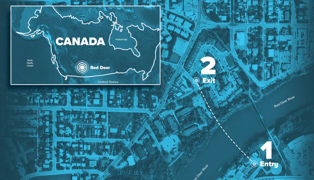
The historical downtown community of Riverside Meadows in Red Deer, Alberta, Canada, is currently undergoing a large upgrade to their aging infrastructure.
The ongoing project once complete, will align amenities in Riverside Meadows with those in newer communities throughout the city. Upgrades were planned to not only roadways, paths, lighting and parks but also additional water, sanitary and storm infrastructure including the water treatment facility itself.
As part of the project, the City of Red Deer proposed to replace two existing water distribution mains that cross the Red Deer River between the soon to be upgraded water treatment facility and the Riverside Meadows neighborhood with a single larger distribution main which would be tied in to existing infrastructure.

The task of delivering the challenging HDD project to completion was driven by Pidherney’s Inc. a local, family owned and operated civil/oilfield construction company with its nearest office located in Blackfalds, Alberta.
The proposed crossing had limited workspace due to other phases of the construction project neighboring each side of the proposed drill path along with several existing utilities located throughout the length of the drill path specifically near the proposed exit location. This along with challenging ground conditions and alignments needed to stay within current road allowances, Pidherney’s elected to contract CCI Solutions to review all project details to provide a feasibility assessment for the proposed horizontal directional drill (HDD) project. The review included but was not limited to a complete geotechnical investigation of the proposed drill path, annular pressure analysis, preliminary crossing design and review of all proposed equipment and tooling for execution.

The final crossing design utilized complex steering geometry including multiple horizontal and compound curves totalling 52.7 degrees planned steer more than 90 percent of the planned drill length of only 326 m. This was done to have the 600-mm HDPE water main installed to have sufficient cover under all existing utilities along the proposed drill path as well as the riverbed to stay within modeled annular pressure estimates and reduce the risk of inadvertent fluid release to surface during pilot hole operations.
As part of the geotechnical investigation and HDD design, it was deemed necessary to install up to 24 m of 36 in. surface casing at the proposed entry location. The temporary casing would ensure hole stability from the planned entry point through granular materials, including gravel and loose sands, through to the underlying bedrock formation approximately 5.2 m below surface.
Due to the complex nature of the planned HDD crossing along with limited access to the drill path from surface typically required for tracking the drill bit location using conventional steering systems, Brownline Canada was contacted to discuss feasibility of the pilot hole execution using its Drillguide Gyro Steering Tools (GST).
Together, Pidherney’s, Brownline and CCI Solutions discussed the appropriate rig size and downhole tooling required to kick start the HDD design into an operational reality. With limited workspace, Pidherney’s requested to use a smaller-than-recommended drill rig size as other phases of the overall project would be continuing on either side of the congested entry location during the ongoing HDD operations. With calculated buoyancy controls provided by CCI Solutions along with a smoother, radially compliant drill path supplied by Brownline Canada’s GSTs it was concluded that the crossing could be completed successfully.
During the pilot hole operations, the use of the Drillguide GST allowed for highly accurate navigational steering information to be gathered while also eliminating the use for above ground tracking of the drill head location. With its ability to provide real time measurement while drilling information without any effects from external interferences, the proposed drill path was followed within combined radii specifications and on target.
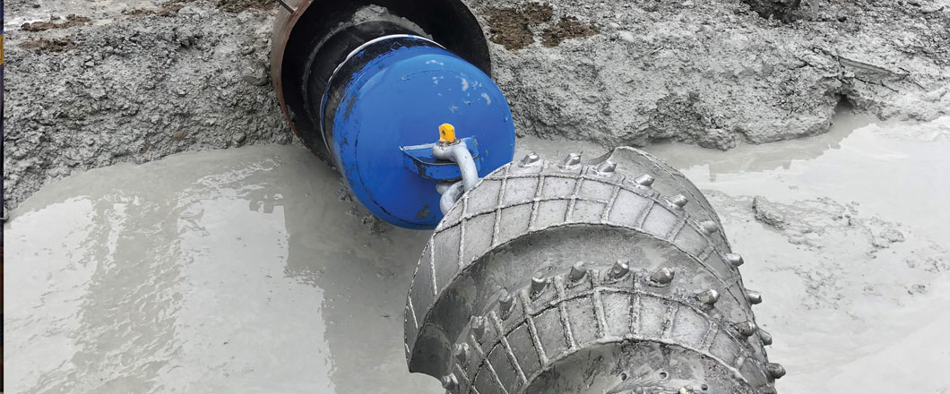
A precise exit point was achieved into a pre-excavated and shored exit pit in order to protect the number of existing utilities in proximity of the tie-in location of the soon to be installed 600-mm HDPE water main. The use of Brownline’s GPS Tracker technology allowed for positional verification of the drill bit location confirming not only the accuracy of the GST’s calculated position but also validated sufficient cover required under the numerous existing utilities located near the exit location prior to completion of the pilot hole.
With the combination of a smoother drill path well within stated radial tolerance, proper reaming practices and calculated buoyancy controls, the 326 m of 600 mm HDPE was installed well under the anticipated pull forces.
“Thanks to our strong HDD team led by Kevin Tonery and our partners at CCI and Brownline, Pidherney’s was able to deliver this complex crossing to the City of Red Deer on time and on budget. Even with the added complexities of limited workspace and multiple foreign utility crossings within the compound curve alignment,” said Ryan Leppke, senior project manager/estimator at Pidherney Inc.
Brownline’s proprietary gyro technology not only continues to advance the HDD industry into greater possibilities on the planning/engineering stages of conventional crossings but also promotes the unnecessary disruption of any surrounding areas outside from entry and exit locations ultimately bringing the HDD industry back to its grass roots. The way its initial conception was intended to be.